Saturday, 8 October 2016 - Flagstaff, Arizona - Grand Canyon, Arizona
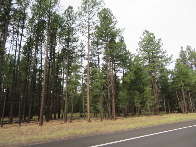
Up and going early this morning with the temperature at around 11 degrees C. A short discussion with the GPS as to the preferred route to the Grand Canyon. I eventually won one and we followed the edge of the mountain through beautiful forests of Ponderosa Pines. The Grand Canyon has the largest stands of these trees in the USA. Very solid deer and elk country but no mishaps, just a few off the side of the road behind a fence.
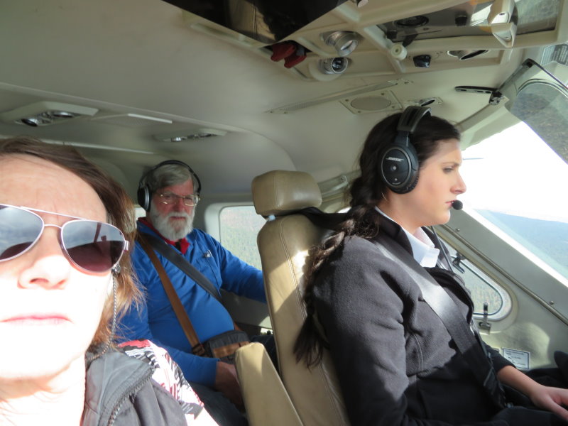
We had a flight over the Grand Canyon booked for 11:00am so time was critical and we arrived with 45 minutes to spare. The early arrival meant that there was no room available, this place was booked out last night and with an 11:00am check-out, no-one was keen to leave early. We did have the benefit of being able to drop off our luggage but then they offered to drop us to the airport and collect us after the flight so that was better still.
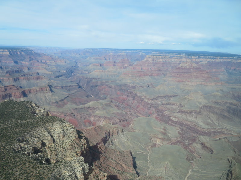
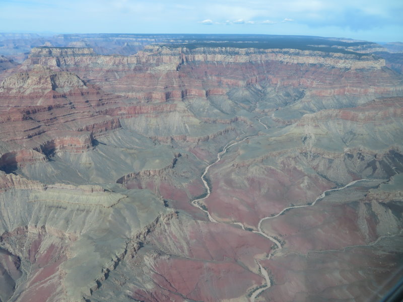
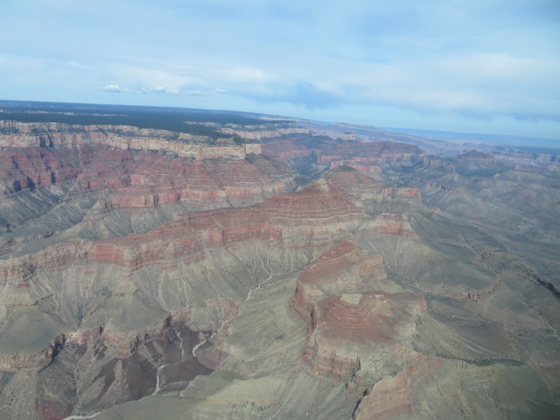
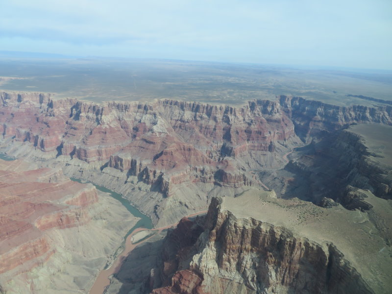
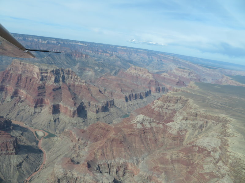
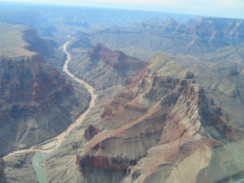
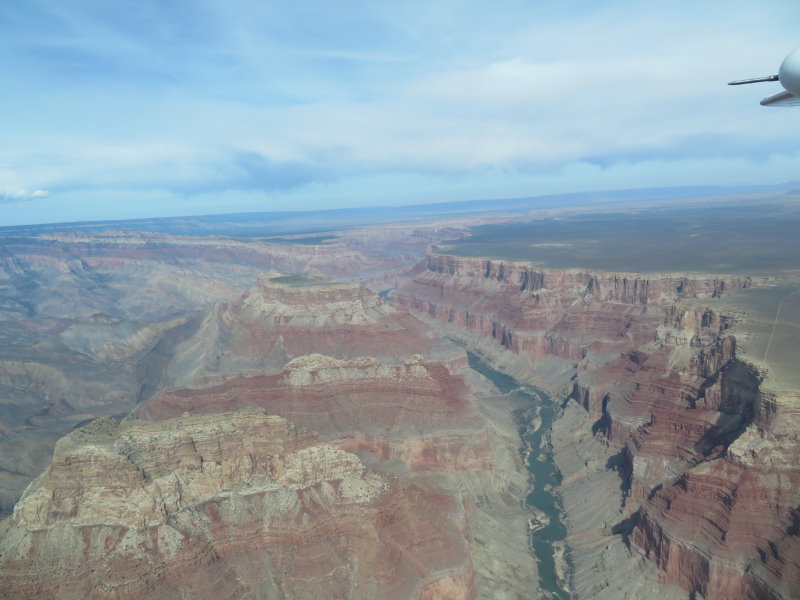
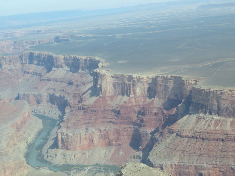
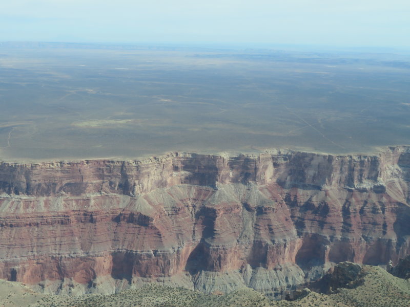
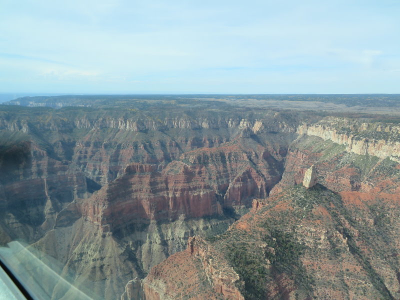
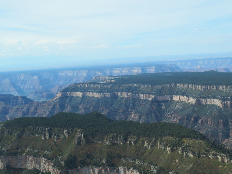
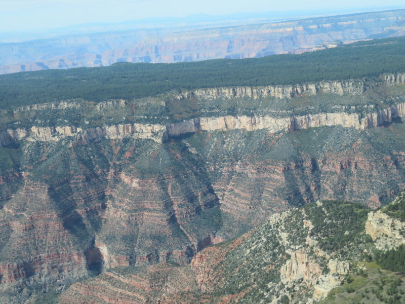
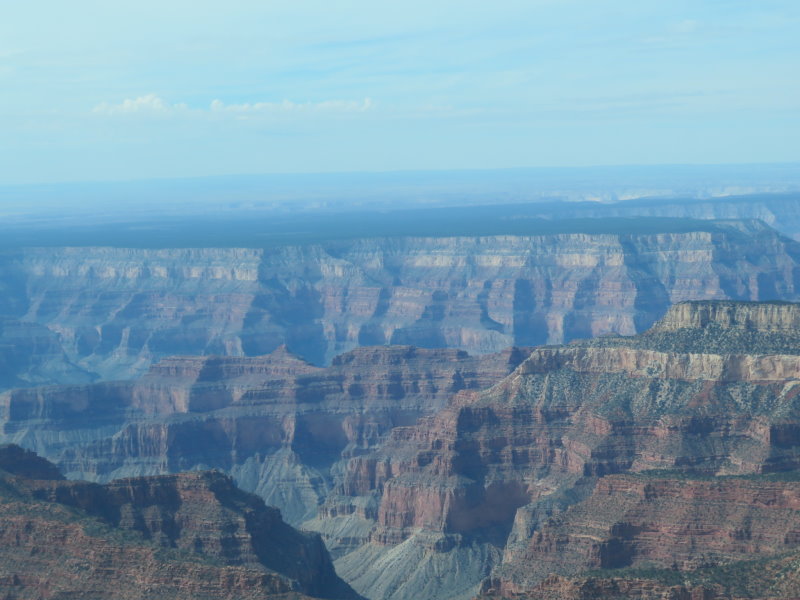
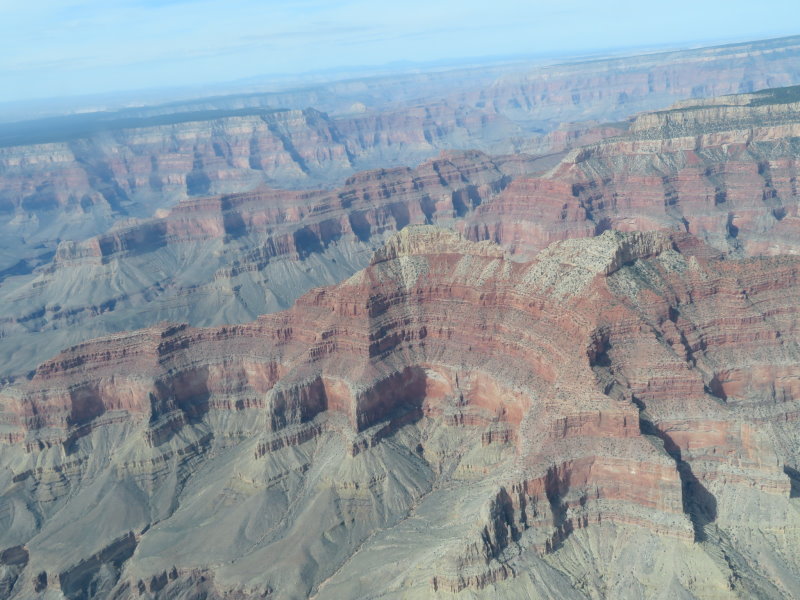
What a great experience, the ability to fly above one of the seven natural wonders of the world and see the magnificence of nature. There was a degree of cloud around today that gave a haze to the day but the photos came out with reasonable clarity. Otherwise we may have had to do it again. Plenty of photos for you.
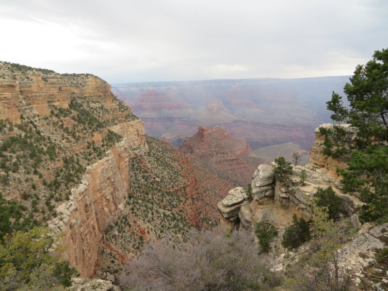
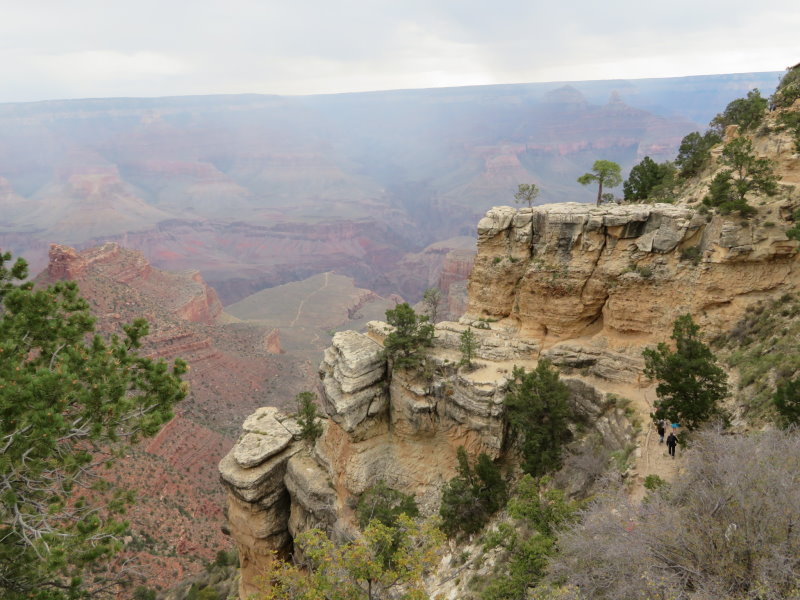
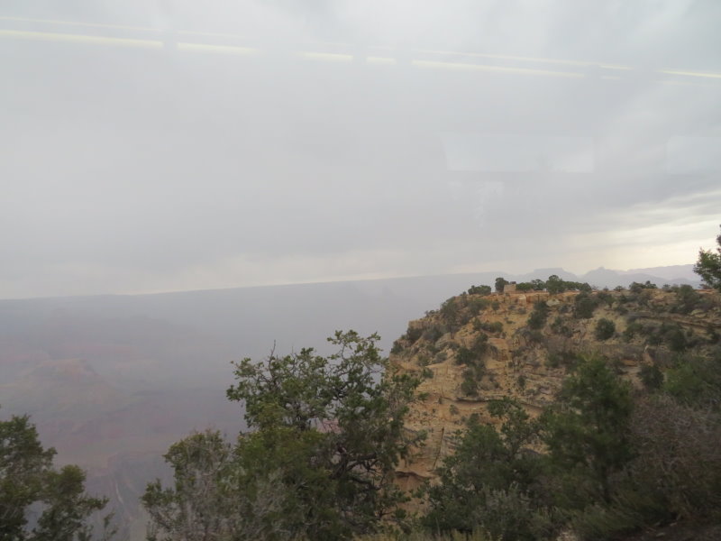
After the flight and lunch, we caught the hop-on hop-off bus to the Grand Canyon Welcome Center where there were other hop-on hop-off buses available for various routes around the canyon rim. By the time we got to the start point of our chosen route, the sky was starting to darken and by the first view point, the first spits of rain had started to fall. Doesn't this sound familiar, we arrive at an attraction that requires clear weather to appreciate it to the full, and it rains. With 15 minutes to wait until the next bus, we checked the view from a number of view points and the rain got heavier then the first of the lightning started quite close. Raining and more lightning by the time the bus arrived with the news to get on board as they were evacuating our route due to the increasing danger from the current and approaching thunderstorms.
On to the next stop for a repeat of the pick-up and we picked up a couple who has been holding the steel rail of the walkway and felt the shock and believed the rail had been struck by lightning.
Of course the mass evacuation of people back to the connecting buses meant that they were overwhelmed so we all ended up standing in the rain for 30 minutes before getting our ride and eventually getting back to our unit to get dried off and warmed up.
We have a bit of free time tomorrow so me may get a chance to have another close look from ground level before we head north to see Horseshoe Bend and Page.
124 klms today, total to date 12696 klms.
Ponderosa Pines
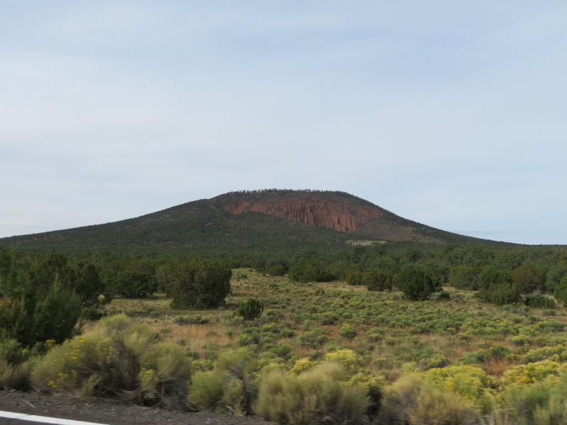
Red Mountain between Flagstaff and Valle
Trading Post, Valle
On the plane flying over the Grand Canyon
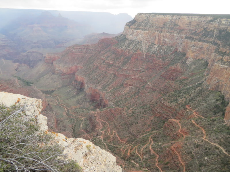
Grand Canyon and the Colorado River
Grand Canyon and the Colorado River
Grand Canyon and the Colorado River
Grand Canyon and the Colorado River
Grand Canyon and the Colorado River
Grand Canyon and the Colorado River
Grand Canyon and the Colorado River
Grand Canyon and the Colorado River
Grand Canyon and the Colorado River
Grand Canyon and the Colorado River
Grand Canyon and the Colorado River
Grand Canyon and the Colorado River
Grand Canyon and the Colorado River
Grand Canyon and the Colorado River
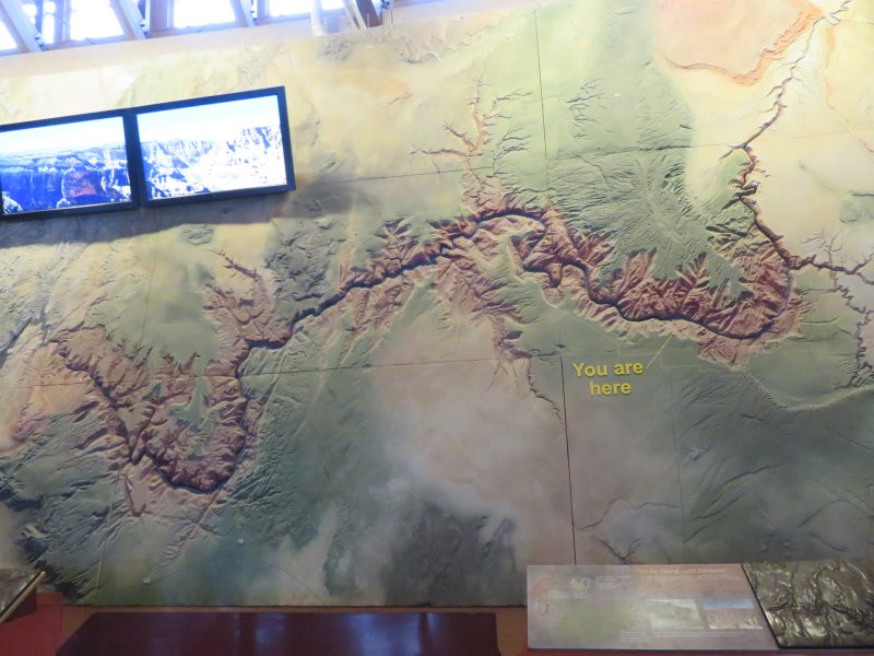
Relief Map showing the 200 mile, 320 klm, length of the Grand Canyon